GPS Satellites Explained
Location, Speed, Direction, AltitudeWhat are GPS Satellites?
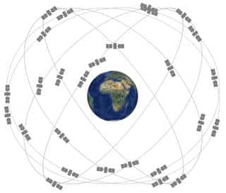
The Global Positioning System (GPS) is currently the only fully functional Global Navigation Satellite System (GNSS). More than two dozen GPS satellites are in medium Earth orbit, transmitting signals allowing GPS receivers to determine the receiver’s location, speed and direction.
The Global Positioning System (GPS) is a U.S.-owned utility that provides users with positioning, navigation, and timing (PNT) services. This system consists of three segments: the space segment, the control segment, and the user segment. The U.S. Air Force develops, maintains, and operates the space and control segments. View GPS.gov
GPS Satellites – From the Beginning
How GPS Works
A GPS receiver calculates its position by measuring the distance between itself and three or more GPS satellites. Since the signal travels at a known speed, measuring the time delay between transmission and reception of each GPS radio signal gives the distance to each satellite. Read more info at GPS.gov.
The signals also carry information about the GPS satellites’ location. By determining the position of and distance to at least three satellites, the receiver can compute its position using trilateration. Receivers typically do not have perfectly accurate clocks and therefore track one or more additional satellites to correct the receiver’s clock error.

