HD GPS Tracking
Unparalleled accuracy and detailHD GPS Tracking
Vehicles, Assets & Equipment
Unparalleled Resolution
Curved based logic (CBL), aka Smart Algorithm, is a patented method for delivering the right information at the right time, providing the highest resolution HD GPS Tracking in the fleet management industry for the same price as slower competitive systems. CBL means the GPS device recognizes changes in speed and direction and adjusts the update rate accordingly. This means that the system updates at a varying rate, not every 1 or 2 minutes.
When a vehicle changes speed by accelerating or decelerating, the update rate increases. When the vehicle is traveling the same speed and direction, like on a highway, the update rate spreads out because less GPS data is needed. If the vehicle slows to pull off the highway, the update rate increase to show the detail.
How GPS Logging Work
When discussing GPS tracking with any fleet management company, you need to understand these 3 elements to get a complete understanding of how their system works. Perhaps the first questions is, “does the sales rep even understand the differences”.
- Log rate – the frequency the GPS device is sampling and logging GPS coordinates (telematics sampled 100/sec)
- Update rate – the frequency the GPS device transmits the GPS data to a communication network, generally a cellular network. This may or may not include all the log points.
- Refresh rate – the frequency the online map refreshes to display new data received by the server, generally 20-60 seconds or on user request.
HD GPS Tracking
Industry leading accuracy
Pro Tip
The GO System provides HD GPS tracking at the same price as competitor systems which update every 1 to 3 minutes. Base mode is below competitor prices and only the GO System enables you to upgrade and add services, equipment and features as needed.
Why not get the best for the same or lower investment? There is no other logical decision.
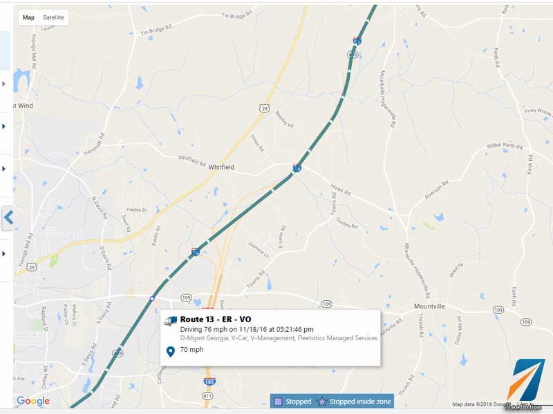
Highway Driving
Data is spread out when high resolution is not needed. As soon as speed or direction changes by more than 2 mph, the GPS device increases the update rate and more detail starts to appear on the customers’ map. The update rate can vary from a few seconds to several minutes.
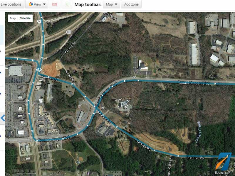
Detail When it Counts
Resolution increases when needed due to changes in speed and direction. This generally means when vehicles are traveling in an urban environment vehicle routes display every turn and stop. This includes coming to a complete stop at lights, stop signs and railroad tracks, harsh braking and jackrabbit starts. This data is independent of the unique accident reconstruction log provided by the GO System.
Extreme GPS Tracker
The farmer wanted to see if the field was being completely harvested and if the passes taken equaled the estimated passes. In enterprise commercial farming, fuel is as important as in the trucking industry.
The GPS vehicle tracker used in this scenario is the same used in a typical fleet customers vehicle. Notice increase logging in the corners and less